Astute readers of this blog (all two or three of you) know that I have climbed something like 1,000 peaks.
About 3 years back when I was approaching #500, I decided to climb a mountain named 500 (Gohyakuyama in Japanese) to commemorate the occasion. There happen to be two mountains with that name in Japan. One is in Niigata Prefecture and the other is in Nagano Prefecture. They are both small, little-known and little-trafficked mountains.
For my first attempt, I went to the one in Niigata on a February day. I didn't realize until I got to the trailhead how unprepared I was for the snow. I assumed the conditions of that mountain would be similar to mountains of the same height in the area I usually hiked around Tokyo. I was wrong. I hadn't taken into account that Niigata, being near the Sea of Japan, gets a lot of snow--even at lower elevations. I didn't have snow shoes or anything like that with me. After traipsing around in thigh-deep snow for a short while, I gave up and went home.
(For #500, I went to Gohyakuyama in Nagano a few weeks later.)
This year, with #1,000 coming up, I have had my sight on the one in Niigata again because 500 + 500 = 1,000. I'm more prepared for snow these days. I sought out hikers in the local area to pump them for information about the snow conditions. I was ready to do it in early February--and the conditions looked good--but I had other commitments and had to wait.
Then, when I had time, the area got belted with snow. It snowed for a week straight and was snowing on the day I had available to hike.
Yesterday, I had the time and it wasn't snowing. The concern was that the area had gotten all that snow recently and then had a few really warm days. The snow could be heavy and there might be danger of snowslides. The guys I had been talking to online said they thought the conditions were good, though. Mrs. Caveman drew my attention to an avalanche warning for Niigata and I said maybe it wouldn't apply to such a small mountain. Mrs. Caveman had better information than the guys on the ground.
I'm sure she's better-looking, too.
Well, the conditions were not good. I could see driving into the area that the snow was very dangerous and there were bound to be avalanches so I decided to give up even before I got to the trailhead.
Drats. Foiled again!
I don't know what those local guys were thinking saying the conditions were good. Was it something I said, I wonder.
I'm resigned to waiting to do this mountain until spring. Truth be told, I've already crossed the 1,000 mark but we'll just pretend that hasn't happened until I finally knock this one off as the 1,000th. The Caveman will get his revenge. This little mountain has now cost me probably 12 hours in travel time and lots of money. The first time I went was by shinkansen from Tokyo. Tolls and gas yesterday were about ¥15,000.
The ride home was pretty. I got to see lots of mountains.
. . . about the mountains on either side of the Kurumasaka Pass
The Kurumasaka Pass is on the prefectural border between Nagano in the south and Gunma in the north. To the east of the pass lie Mt. Kuruma, Kurofu and Mt. Asama beyond. To the west there is a line of mountains which gradually decrease in elevation until they end in the river valley that runs through Ueda City about 15 miles to the west. On the Gunma side of the pass is a ski area called Asama 2000 Park.
Area:
Location:
Map: ***If you want a link to the latest Yama to Kogen map, comment and I'll get you a link. This link is to a printable topo map
Peaks bagged: Mt. Takamine (高峯) ~ Mt. Mizunoto (水ノ塔山)
(First-time) peaks # ーー
Getting there/getting around:
There is lots of parking at the Takamine Kogen Visitors Center.
There is a bus stop at the Kurumasaka Pass serviced by JR Bus. You can get a bus there from Komoro Station or Sakudaira Station if you are already in Nagano. There is even bus service to that bus stop from the Busta Terminal at Shinjuku Station.
If you can read Japanese, the Takamine Onsen's website has the best detailed information for transportation. It's possible to get there via shinkansen and bus in 2.5 hours from Tokyo.
Total Time: 4:20 hours Break time: :30 Distance: 7.1 km
Elevation:Lowest: 1,941 m Highest: 2,202 m Total Ascent: 604 m Total Descent: 604 m
Technical considerations/difficulty:
Since this is a winter hike, it should go without saying that you need the proper dress and equipment. Snowshoes or wakan are a very good idea. At a minimum. you need spikes on your feet. The snow is quite deep so be prepared to fall in up to your waist. None of the trails on this hike have chains or ladders but there are some boulders at the top of Takamine and on the approach to the top of Mizunoto.
Most of the hike goes by areas with a fair amount of people. About midway through the hike, you start to pass by a few chair lifts. I was just starting to feel serene in the snow and paused to listen to the winter silence when what should I hear but Ann Wilson screaming she was going to go crazy on me from a speaker on the nearby chairlift. The idea of Ann Wilson doing that 50 years is intriguing. Now, not so much. I guess classic rock is all the rage at that ski area. But I digress.
Anyway, there is a ski area and a mountain lodge/onsen that you pass on the way. The lodge gives classes on snowshoeing so you see some people doing that. Beyond that lodge and the last ski lift it gets a bit more solitary on the way up to Mizunoto. Basically what I'm saying is that this is a fairly risk-free endeavor for most of the way. The ski areas blaring the hits of the 70s and the lines of old ladies walking like ducks through the snow would make it hard to get lost for most of the time in this area.
Facilities:
Takamine Kogen Visitor Center The parking lot is here. Public restrooms. Restaurant. Educational displays. Hiking goods (including everything for snowshoeing) for sale. The equipment and prices weren't bad. Snowshoes and equipment for rent.
Takamine Kogen Hotel Hotel right at the Kurumasaka Pass. The trailheads for Mt. Kurofu to the east and Mt. Takamine to the west are here. Fun fact. At night I can see their lights from where I live 12 miles away. The first time I spotted the little speck of light I though it was a UFO.
高峯温泉 日本語版Takamine Onsen (English) (The "English" link is quirky. Half of the page is translated into English, another half of the page is in Chinese.) This lodge is at the trailhead to Mizunoto, about halfway through the hike I record in this post. A ski slope passes in front of it and there are benches to catch the view from there. It's pretty year round. There is an onsen. They offer free training in snowshoeing. I've never been inside, but I have walked by it several times. It is possible to drive there in the summer on the very bumpy forestry road. During the winter only snow vehicles can get there. Their website has a schedule for that service. Click on the アクセス link on the left side of the page and then scroll down the page to 雪上車運行時間.
Thoughts/observations/etc.:
I've had precious few days to get into the mountains this month. My last hike was on Mt. Kenashi down near Mt. Fuji on the first day of the month. That was nice--but there wasn't much snow. I have sorely wanted to get out on into the snow while the winter is still here.
This weekend was my first chance to get out and I decided to stay in my backyard as it were. I can see Mt. Asama and its neighbors from my home and was looking up at them longingly for the past several days. Every day had been characterized by blue skies and the rugged snow-capped peaks were calling me.
When I finally got the chance to go, the sky was cloudy. All the mountains I'd been looking at were hiding from me as I drove steadily up from Saku City into Komoro City and into the hills. It's a chore for my little car's little engine to chug it's way from and elevation of 675 m to almost 2,000 m. At one point I was going 20km/h despite putting the pedal to the metal.
It was nice to get into the snow. On this day, I was wearing a new pair of wakan (snowshoes) and was excited to try them out. (They are great, by the way!)
Unfortunately, it was cloudy until I got to the first peak. Then my iphone stopped responding and I couldn't take any pictures. It did clear up and become beautiful👍 but I got no pictures👎. Also, my GPS stats were lost. That was frustrating. The snow was so beautiful that if reminded me of a marshmallow world. I wish I could share pictures of it with you. I'll share pictures I took in the area in the summer to give you some idea.
My smartphone's becoming unresponsive made making this map difficult. Reading it is probably even more difficult than it was to make.
Let's be honest, though. Do I have any reason to think any of you is going to try and puzzle your way through my ADHD-addled scribbles?
Here's a video of the day:
My new toys! These are called wakan or kanjiki in Japanese. This type of snowshoe is more adapted to climbing slopes than traditional snowshoes. These don't have the buoyancy of regular snowshoes so you will sink deeper if you break the surface. They are easier to pull out of the snow than snowshoes, though. There are lots of tradeoffs and opportunity costs to either type of shoe you choose.
These cost me ¥9,900 at Montbel and I really am glad I got them.
The Takamine Hotel, by the Kurumasaka Pass.
This torii is probably 12-14 feet high.
This is what it looks like with less snow.
Great temperature for hiking in the snow. If it gets too warm, the ice melts and refreezes in your footgear and you can encounter mud which is also an inconvenient mess. It's much better if you are below freezing all the time.
The top of Takamine. Takamine means tall peak.
Here's me handsome mug at the shrine on top of Takamine
This is where I was. I took this picture from my neighborhood.
Soon after I left the top of Takamine--and just before the sky cleared up--my smartphone stopped working. So I was unable to take any pictures for most of the hike. Mt. Mizunoto is higher and had great snow scenes.
Sigh.
To supplement what I missed, I'll put some pictures I took of the same area in the summer.
This is the trailhead to Mt. Mizunoto, just in front of the Takamine Onsen. The clearing to the right is a ski slope.
On the way up . . .
The top of Mt. Mizunoto
"Mizu" is water and "toe" is pagoda or tower.
This sign was mostly buried when I was there this past weekend.
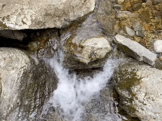
There are some beautiful flowers in the area. Especially just behind the parking lot at the visitor center.
I'll end with a few long shots I took from Takamine on that summer day.
That's all for today.
I still haven't gone to the mountain I am planning on for my 1,000th peak. I wanted to go earlier this month but that mountain has been getting absolutely walloped with snow. Hopefully I can get there next weekend. Even if I go there, I am not sure it will be hikeable. It's quite far away and although I am communicating with a few locals, I really won't know what the conditions are until I see them for myself. This will be my second attempt at this mountain. The first time I turned back. If I have to turn back again, I will . . . but I will bag this peak sometime. If if has to wait until summer, I'll go back again.
Take a look at these posts if you want to see more of this area: