Caveman climbs another 100 Meizan, Nasudake in Tochigi

Greetings and salutations cavedwellers.


Nsudake


Before I begin, let me just say that Mrs. Caveman is the best wife in the world.  Today's post comes to you because of her generosity.  She gave me the dough to take the train for this past trip and it was greatly appreciated!

Yesterday, I climbed another one of the 100 Famous Mountains.  Mt. Nasu is in Nasu (city), Tochigi (prefecture).  Nasu is at the extreme northern part of the Kanto Plain, bordering the Tohoku ("East"-"North") region of Japan.  Actually, I entered Tohoku on this hike because I stepped over the prefectural boundary into Fukushima for just a bit.

One reason that I put off this trip for so long is that it was difficult for me to balance the expense in time and money for the travel against the amount of time in the mountains.  Taking the local trains up and back can be done much more cheaply than taking the shinkansen.  But that would take so long as to make overnighting a necessity.  Also, the actual hike up and back from the top of Mt. Nasu can be done in just over an hour.  When Mrs. Caveman asked me what I wanted for our anniversary, I asked if I could take a shinkansen ride.  She said yes.  She is the vest!  (That means very best.  I just coined that word.  Feel free to use it yourself.)

So, I took the shinkansen and added several mountains to the suggested itinerary and had a great daytrip.

Here are the details.  I'll add pictures and commentary later.


google earth Nasudake


Location:  Mt. Nasu (Mt. Chausu)

Starting and stopping point:  Start at Kyukamura Nasu Bus Stop   Finish  Nasu Ropeway

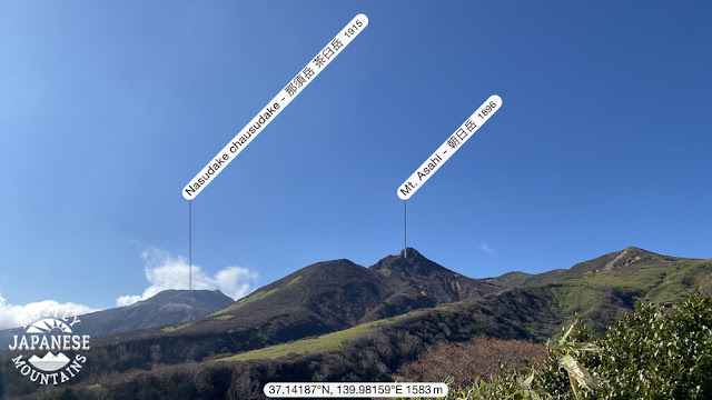
Mountains climbed: Nakaokura~Maedake~Sudare~Sanbonyaridake~1900mine~Asahidake~Kengamine~

Chausudake(Nasudake)

Getting there/getting around:  I took the shinkansen to Nasushiobara.  From there, there are buses to the Nasu Ropeway and all the onsens and other tourist attractions on the way.  One-way bus tickets to the ropeway costs about ¥1,300.  A two-day free pass costs ¥2,600.  The Ropeway is a separate expense.  See here for business hours and prices Nasu Ropeway .

Map:  Yama to Kogen Chizu # . . . Beats me.  I just printed a map off the internet (YAMAP) this time.

Weather Information:  Nasudake Weather

Time and Distance:  6 hours, 15 minutes plus a break for lunch 16.16km (Just shy of 10 miles)

Elevation:  Lowest:  1,200m Highest:  1,915m Total Ascent:  1,498m Total Descent: 1,039m

Technical considerations/difficulty:  There are some steep spots, but most of this area is actually pretty easy.  There are not a lot of chains or ropes and the trail is very well-maintained while still keeping a very natural feel.  There are large areas of bamboo grass and I especially appreciated that they had trimmed the trail.  Bamboo grass is nice to look at but it is really annoying if you have to wade through it.

Facilities:  Not a lot.  Once you are on the trail, you won't encounter any restrooms or commercial entities.  There is one waterhole on a spur that I took but that water was un-drinkable--unless maybe one was dying of thirst.  πŸ˜‰  That would make it ok.

Thoughts/observations/recommendations: Boy, what a great area to hike.  It's been on my list for quite a while.  I am so glad I finally did it.  It exceeded my hopes.

OK.  Here are my reflections looking back on the day.  I will start with the journey up from Tokyo . . .

This was something neat to come upon when pulling into one particular station on the way up.  I think this might have been in Oyama.


Rather than start at the ropeway, I opted to start at a bus stop a few miles away and take a roundabout route up to the mountain.  For the first few hours, my hike was a very solitary pleasant excursion.  One of the first sights I encountered was these falls.

Komadome Falls


The Yosasa River


The Kita Onsen (Hotspring) is next to the river.


It was just such a picture-perfect, pleasant day.  The temperature was around 8~9 C (50ish in Fahrenheit) for most of the day.


The first landmark I got to was the top of the ski area, Mount Jeans.  I've been skiing there many times in the past but this was my first time up there without snow--or people.


I am glad I brought water with me.  This was the only waterhole and the water was crunchy.  😱


There is a video if you want to see how it operates.


This is totally natural but it looks like something that was arranged for a zen garden.


From Mt. Jeans, I headed up to Mt. Mae (Maetake).  That was really not much to see.  Then I headed up to Sanbonyaritake ("Three" "Spear" "Peak") and had lunch.  That's where I first started to encounter people.  

This is the only time that visibility got bad.  That was unfortunate because you are supposed to be able to see Mt. Bandai in Fukushima from here.  I like that mountain and would have liked to have gotten a glimpse of it from afar.


On Sanbonyaritake.  This disc is oriented so that north is up and south is down.  It shows all the mountains you should be able to see from that point.


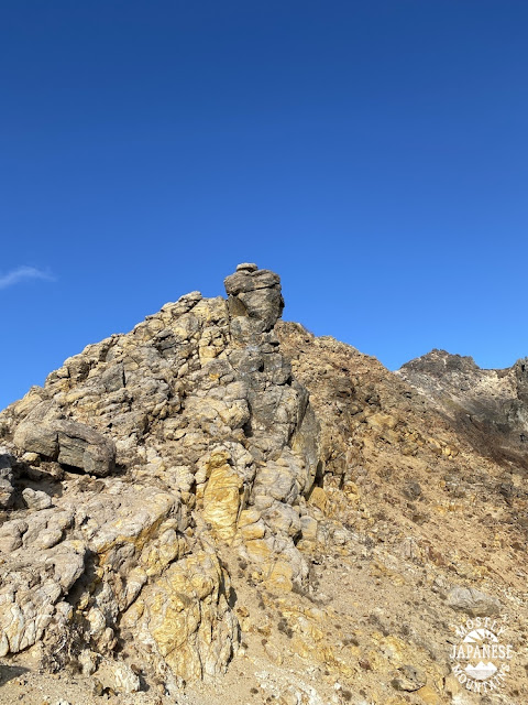
This spot is just below Mt. Asahi's peak.  It's cool.  Check out the video to get an idea on how windy it is.


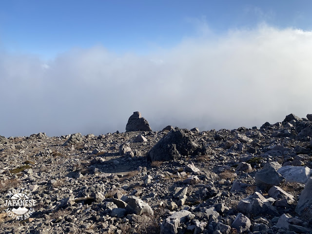
The top of Mt. Asahi


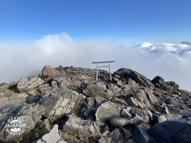
The top of Nasudake


No trip is complete without a memento.  I was fortunate enough to take a digger into the gravel on the way down.  These little scars 🩹will give me happy memories until they heal.  πŸ™‚


That's all for now.  Don't forget to subscribe.  All the cool kids are doing it.


Addendum:
Here at work today I took a look to the north with my Peakfinder app and was astonished to find that Sanbonyaritake, one of the mountains on the other day's hike, is in the line of sight from here.  That's 174km away!  It's obscured by clouds in this picture, unfortunately.  Just knowing it is there made it a little hard to concentrate at work.  😜 

Mts Nantai (男体) and Shirane (η™½ζ Ή) are very visible in the picture.  Those are 124km away in Nikko.

Want to check out one of the other 100 Famous Mountains in Tochigi?

How about a different area?


That's all for now.  Subscribe.  Comment.  Have a nice life.

Caveman out


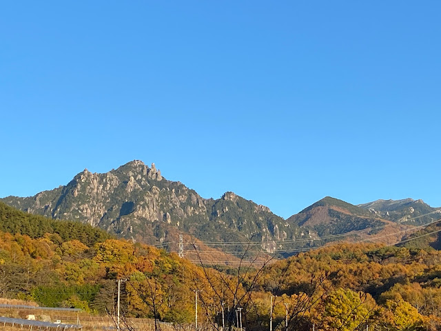
Caveman does a peep show in Yamanashi. Peeking the leaves at their peak from the peak of Mt. Mizugaki.


Greetings cavedwellers


Yesterday I made my third trip out to Hokuto-shi (Hokuto City) in Yamanashi, to the area around Mt. Mizugaki.  Here are the details.  I'll blather on later.


Location:  Mt. Mizugaki, Hokuto, Yamanashi

Starting and stopping point:  Daimeniwashita Boulder Parking Lot ε€§ι’ε²©δΈ‹γƒœγƒ«γƒ€γƒΌι§θ»Šε ΄

Mountains climbed: Takamiiwa~~Iimori~~Mizugaki 

Getting there/getting around:  The Mizugaki Sanso is accessible by bus from Nirasaki train Station

Map:  Yama to Kogen Chizu #27 KINPU-SAN・KOBUSHI OKUCHICHIBU ι‡‘ε³°ε±±・η”²ζ­¦δΏ‘ ε₯₯秩爢

Weather Information:  Mt. Mizugaki Weather

Distance:  13.5km

Elevation:  Lowest:  1,456m Highest:  2,230m Total Ascent:  1,456m Total Descent: 1,456m

Technical considerations/difficulty:  This is a hike with a lot of scrambling and climbing.  ⛰ The top 200 meters of ascent necessitate climbing with both hands and feet.  Despite the necessity of using hands as well as legs, there are few chains or ladders because there is a plethora of tree roots and rocks to use as handholds.  Also, it's not very exposed except at the top.  Snow has already started to fall on nearby Mt. Kinpu (2,499m)πŸ” but none had fallen yet on Mizugaki.  I saw climbers of all ages yesterday.  Some people looked less happy than others, though.  πŸ˜†

Facilities:  There is food, lodging and a restroom at the nearby Mizugaki Sanso and there are the same amenities as well at Fujimidaira Hut.  There are also tent sites at the hut.  There are other campgrounds in the local area as well.  A free waterhole is about 5 minutes down the trail from the Fujimidaira Hut.  There are no more restrooms above that hut.  Be prepared for a long wait between bathroom breaks.

Thoughts/observations/recommendations: This is really a wonderful area.  I hiked around here for the first time two summers ago.  That was awesome.  This time, visiting in autumn, was great, too!

Now, for my blather.  The reason I put the blather last is because I assume my some of my cavedwellers might be bothered by blogger blather the way I am.  Oh, brother.  What a bother to be bothered by a brother blogger's blather.  

For example, I like to cook.  Sometimes I get the idea to make something new and fire up the google machine (btw, don't believe them, google is evil) and search for a recipe for that dish.  Invariably, I find myself at a blog and usually the post starts, not with the recipe or a list of ingredients, but with a sentence like this, "My Pa-paw--who had high cheekbones--really liked his cold crab omelets . . . "

Then I have to scroll down through the family history and organ recitals, "That's when Aunt Betty had gout.  Poor thing. . .", and hunt for the recipe.  If I was interested in someone's heritage, I would be checking out ancestry dot com instead of recipes 'r us.  While some of these blogposts are interesting, there is only about a 1/1,024 chance that I care about the life story of the cook who is writing it.  (She is probably lying about Grandpa Ambrose Finnigan, anyway.  Come on, man.)

OK, that's done.  

I haven't blogged in a bit.  My past couple of hikes were local and I've blogged those spots to death.  Yesterday was different.   I got to one of my favorite areas and caught the fall colors at their peak. 

Like I was saying, this area around Mizugaki is great.  Mizugaki is one of the 100 Famous Mountains as well as is nearby Mt. Kinpu. 


I left home at 5 am.   I thought I'd get to the area about 9 but some of the areas I passed through were too pretty and I found myself stopping to take a lot of pictures.


Starting out.  
As you can see, the weather was gorgeous.  It was very comfortable for hiking.  It was right around 50 degrees all day.


This is just before the top of Takamiiwa ("Hawk View Boulder").


From Takamiiwa


After Takamiiwa, I went hunting for the peak of Mt. Imori.  There was no trail.


There was nothing to see when I got there, either.  This is the marker for the top of that mountain.


Mt. Mizugaki from below.

That cool view of Mizugaki


very cool trees on Mizugaki

On the top.  
Had lunch here around 2 pm.  It was a national holiday yesterday, so I wasn't alone.
Can you spot the photoshopping I did to "fix" this shot?

top of Mt. Mizugaki

Mt. Imori, Takamiiwa and Fuji from Mt. Mizugaki

Gorgeous Fuji from Mizugaki


One of the bouldering boulders below Mizugaki


Inside the Fujimidaira Hut

antlers at the Mizugaki Sanso

I got my antlers for free - - That was a really cool experience.


komorebi near Mizugaki


Heading home

I was driving straight toward Fuji for a while on the way home.  
Cool.


That's all for now.  Mrs. Caveman has given me permission (and more importantly train fare) to go somewhere far tomorrow so I need to get to bed.

Don't forget to subscribe for updates.  Comment away.  It costs you nothing and makes me feel like I'm an "influencer."  
On second thought, I don't want to be one of those.  🀣


Want to see another of the 100 Famous Mountains?  Check out Kobushigatake.

Caveman out