Location: Asama, Komoro City, Nagano
Starting and stopping point: Takamine Kogen Visitor's Center
Peaks bagged: Kurumazaka Yarigasaya Tominokashira Kurofu
Getting there/getting around: There is a large parking lot behind the visitor's center. There is also bus service to Komoro, Sakudaira, and even Shinjuku. JRBusKanto runs a bus from the Shinjuku Bus Terminal. It takes 4 hours and costs ¥3,400. I think there is one departing Shinjuku around 10:30 and a return bus at 16:20.
Map: Yama to Kogen Chizu 19 浅間山軽井沢・長野原の山々ASAMA-YAMA KARUIZAWA-NAGANOHARA-MOUNTAINS
Weather Information: Asama Weather
Total Time: 2:16 Break time: 11 Distance: 5.3km
Elevation: Lowest: 1,966m Highest: 2,404m Total Ascent: 493 Total Descent: 493
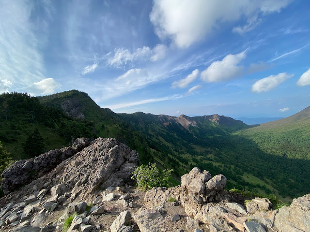
Technical considerations/difficulty: This is a fairly straightforward hike. It's not very long. The trailhead is at a mountain pass so you're already as high up as a car can take you. Most of the hike is below the treeline but when you pop out onto the peaks on the edge of the valley facing Mt. Asama it is a bit dizzying. There are no chains or ladders, but you do need to scramble over some boulders. I really wouldn't want to slip off of one of those rocks. Alltrails calls this hike "hard". YAMAP gives it 3 out of 5 for "strength". I don't know if I'd call it hard...Perhaps if you only put on your hiking boots once in a while.
At the visitor's center, there are the ubiquitous warnings about bears. I'm starting to pay a little more attention to them because there do seem to be more bear encounters in this corner or Nagano and Gunma than I'm accustomed to in other areas. That said, I am still not getting a bear bell. Wow, I find them obnoxious.
Facilities: The visitor's center is remarkably clean and large. There's a snack bar, rental helmets, poles, gaiters, brochures, some items of clothing for sale, vending machines, and restrooms. It's a happening place. Next to that is the Takamine Kogen Hotel which has a commanding view of the valley below and Yatsugatake beyond. Behind the hotel, there are more restrooms open 24 hours a day. There is no water on the trail. There is a very rudimentary emergency shelter on the trail. It's basically just a big tube open on both ends. I assume this is purposed more for protection from eruption than for anything else.
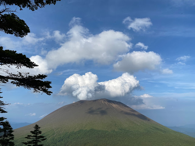
Thoughts/observations/recommendations: This hike was a bit of daytime reconnaissance for doing the same trail in the dark later this summer. When I was doing some trail research the other day, I came across an ad for a tour to see "Diamond Asama" at sunrise: Diamond Asama tour . That sounds like fun! I learned about the diamond effect from Mt. Fuji. As the sun sets or rises directly behind the mountain, rays of light get super bright. Now, I think it's nice that these people are giving a tour to see the effect--but they are charging money. One of the things the caveman dislikes--almost as much as he dislikes pretentious jerks who refer to themselves in the third person--is spending money. Armed with the date and place when the diamond effect is likely to occur, I decided to check out the trail in daylight ahead of time. It was a great excuse to go for a short hike after work on a Thursday afternoon!
Thankfully, there was another brief window of nice weather in this rainy season so that I could do it! We have had a few days of real torrential downpours recently so yesterday's clear weather was just the bees knees. It was almost as good as sliced bread.
And, hiking at that time of day, on a weekday no less, meant that I had the trail and peaks all to myself.
Today's listening: Bible in a Year
There's another trek around Asama here Kurofu, etc.
The actual sunrise hike is here.
Here are the stats and some pictures:
I saw this guy on my way up the road to the trailhead. I call him Fred. Fred the animal.


