Location: Gunma, Nanmoku
Starting and stopping point: Kurotakisanfudoji Dai 2 Parking Lot 黒滝山不動寺 第2駐車場
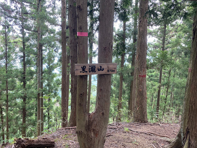
Peaks bagged: Kurodaki 黒瀧 ~~ Takanosu 鷹巣 ~~ Kanoniwa観音岩
Getting there/getting around: Car
Map: Yama to Kogen Chizu #21 NISHIJYOSHU MYOGI-SAN・ARAFUNE-YAMA 西上州 妙義山・荒船山
Weather Information: Mt. Arafune's weather (not too far away)
Total Time: 2:41 Break time: :14 Distance: 6 km
Elevation: Lowest: 591 m Highest: 870 m Total Ascent: 686 Total Descent: 692
Technical considerations/difficulty: The trail up to Kurodaki is not so challenging, physically. It's hard to follow, though. The portion of the hike out to Kanoniwa and Takanosu is thankfully provided with a lot of chains and ladders. There are really necessary. Much of that part of the hike is on a very narrow ridge that falls off quite precipitously on both sides. It's very exposed in many parts and I would not like to go there in winter.
Facilities: There are two parking lots at the Fudoson Temple. I think there was a restroom, but I don't recall.
Thoughts/observations/recommendations:
Wow, I'm glad I did this today. I had a few hours to play with and wanted to get out but the weather forecast was iffy. Well, I should say that the forecast(s) were not definitive. I was looking at four different forecasts. One called for 70% chance of rain, another for 30% chance, another that said it wouldn't rain at all and yet one more that was calling for torrential downpours over the whole island of Honshu. I am pretty sure that forecast was warning about a sharknado, too.
What to believe? What to believe? I decided to just go and turn back if the weather was bad. I left home and it started sprinkling while I was driving. I decided to go as far as the trailhead and then decided. I got to the trailhead and it started raining a little more. I decided to just start hiking and see what happened.
Wouldn't you know it, but it stopped raining within a half hour or so and, by the time I got to my first scenic lookout, it was pretty clear. Woohoo!
(And the climate activists expect me to believe their predictions about the weather in 10 or 100 years? Oh, please. We can't even figure out if it's going to rain in the next few hours. Enough about that topic.)
Anyway, it was a great way to end the day. These are not high hills but they are a bit thrilling. They remind me of many of the mountains in Saitama. They are not that high but many of them are pretty extreme. I worked up a good sweat and got the old Timex in my chest cavity ticking.
Today's listening: Bible in a Year
Let's look at some pictures.
It was very cool looking down at this village.
Thanks for visiting my mancave. I enjoyed today so much that I'm hoping to do it again real soon.


