Showing posts with label #hiking #Japan #hikinginjapan #3000 meters. Show all posts

Japan's 14th-highest mountain. Japan's second-highest volcano. 10,000-footer, 100 Famous Mountain, gorgeous Mt. Ontake in Japan


御嶽山


S'up?

Earlier this week, I went for a road trip to the Hokuriku and Chubu Regions to bang out two mountains.  The first one was Mt. Haku in Ishikawa.  This report is about the second mountain, Mt. Ontake, which straddles Gifu and Nagano Prefectures.

. . . about Mt. Ontake 

Maybe I wrote enough in the title.  This is a lovely mountain that last erupted in 2014.  The name Ontake (御嶽山) means something like "honorable" "high peak."  It is not only one of the 100 Famous Mountains, but it's listed as one of Gifu's 100 Famous Mountains, one of the 100 Famous Flower Mountains and one of Shinshu's 100 Famous Mountains.  It really is kind of a big deal.


Location:

Map:  ***If you want a link to the latest Yama to Kogen map, comment and I'll get you a link.  This link is to a printable topo map of this area.

Starting and stopping point: 

Tanohara Base Parking Lot


Beward of Bears

Probably not a concern here.  The last sighting on the mountain was a month prior.

Peaks bagged: Mikasa (三笠山) ~ Otaki (王滝頂上) ~ Ontake Kengamine (御嶽山・剣ヶ峰)

(First-time) peaks # 1,142~1,144

100 Famous Mountain  #67

Getting there/getting around:  

I drove.  It's a long drive.


Helpful Info

Weather Information: 


Time and distance

YAMAP's Estimate Time:  5:35    Distance: 7.2 km
The Caveman did it in: Total Time: 4:53  Break time: :38  Distance:   7.6 km
Elevation:  Lowest: 2,185  m Highest: 3,067 m Total Ascent: 963 m Total Descent: 963 m

Technical considerations/difficulty:  

Steep.  Chains.  Ropes.  Several places you need both hands and feet.  That said, there were grandparents with grandchildren on the trail.

Facilities:  
Make sure you pee before you start out.  You won't see a restroom (or an unobservable tree) until you get to the top.

No water on the trail.

There are emergency huts at the 8th, 9th and 10th stations.


Thoughts/observations/recommendations:  

As with almost every other mountain I've done, I am glad I did this one.  The scenery was great.  I enjoyed looking back at Hakusan, which I had climbed the day before.  I also enjoyed seeing Mt. Fuji and many other mountains I've climbed.

I was particularly surprised to see Yatsugatake and Mt. Asama, which I live near.  


(Along with all the regular stuff such as maps, headlamps, boots, feet, and brains, . . .) don't forget:

A helmet.  I'm not sure if it's mandatory, but they really want people to have helmets in case of eruption.


Picture time


The stars from the Tanohara Parking Lot were beautiful all night.  There were several photographers with serious cameras recording the sights.


I slept late and didnt leave until about 4.  First, I walked up the small hill next to the parking lot to bag the peak called Mikasa (三笠山).


There is the mountain.  The highest peak is hiding behind the visible peak, though.


This is considered a sacred mountain, so there are shrines everywhere.
As a Christian, I see mountains as sacred also--but in a very different way.  I worship the Creator that created these creations.  To me, they are sacred because of Who made them.  Shinto worships the mountains for themselves.
I think of it like this--the Japanese love the gift.  I love the gift giver.
I honor the fact that the Shintoists see something spiritual in the beauty and majesty of the mountains, but I think they're mistaken in their perception.


I am definitely acclimated to hotter weather these days.  I needed to wear a long sleeve shirt and a fleece in the morning.  Usually, I would hike in shorts and a t-shirt at these temperatures.
(The first screenshot is Fahrenheit.  The second is Celsius.)


That pointy thing in front of the clouds below is Mt. Mikasa, the peak I went to first thing in the morning.


Fuji made it's first appearance sometime after I passed the 8th Station.


The 9th Station
Note the bullhorn.
They are prepared to prompt people to evacuate as quickly as possible in case of another eruption.
63 souls perished in the eruption in 2014.


Otakichojo
This is the peak that is visible from the Tanohara Parking Lot.


It's kind of funny that the sign for the restroom is directly below the sign denoting the peak.


Just past the sign for the top of Otakichojo is a shrine.
You feel like you are at the top of the mountain...


....until you pass through the shrine and see the top off in the distance.
😂


Emergency shelters in case rocks and lava are rain down from the sky.


Oila.  The top


The day before this, I climbed Mt. Haku.

This is what Mt. Ontake looked like from there.


...and Haku from Ontake


The area closest to the caldera is restricted.  This is the closest I could get to the crater.  I did get to see puffs of smoke a few times.


That's all.

Now, I have to get ready for a hike on Shirouma!

Interested in that hike on Mt. Haku?
Click here.


Before I say goodbye . . .

Have you subscribed?

Have you shared the Caveman's info with your friends?

Have you commented?  (No, you haven't.  Be honest.)
Leave a comment, will ya?

Have you been to my instagram Caveman1085 or youtube Caveman on Youtube channel?

Have you kicked in some sheckels?  If you people duke me enough ducats, I'll climb the rest of the 100 Famous Mountains and tell you all about it.  Click the Buy Me a Coffee button if you're feeling generous.

Thank you for your attention to this matter!
Caveman out


Caveman conquers the 17th highest peak in Japan. Mt. Senjogatake of 💯 Famous Mountain Fame


Greetings cavedwellers.
This is a report on Mt. Senjogatake (仙丈ヶ岳), the Queen of the Minami Alps.


Senjogatake (仙丈ヶ岳)

. . . is a mountain in the northern Minami Alps.  It is one of Japan's Famous 100 Mountains and is also on the list of Japan's Famous 100 Flower Mountains.  The actual reason it was named Senjo, which means measure, was lost in the memory dustbin of history quicker than I can say "Where'd I put my stupid car keys?"  Because of it's gentle curves, it's colloquially known as the Queen of the Minami Alps.  This is in contrast to its pointier and, dare we say more masculinely shaped neighbor, Mt. Kaikomagatake.  That one is known as the Prince of the Minami Alps.  (Who made up these nicknames, anyway?  Sigmund Freud?)

Since it's not particularly dangerous, Senjogadake is seen as an entry-level kind of mountain for those first venturing into mountains over 3,000 meters high.

Area:

Northern section of The Minami (Southern) Alps.  Ina City, Nagano and Hokuto City and Minami Alps City, Yamanashi


Location:

Map:  ***The Caveman is giving up on posting links to Yama to Kogen maps.  They go out of date after a year or so and the links die.  If you want a link to their latest map, comment and I'll get you a link to their latest map of the area.

Online interactive topo map


Starting and stopping point: Kitazawa Pass Bus Stop 北沢峠バス停


Peaks bagged: Kosenjogatake (小仙丈ヶ岳) ~ Senjogatake (仙丈ヶ岳) ~ Daisenjogatake (大仙丈ヶ岳) ~ Uma no Se (馬の背)

(First-time) peaks # 942~945

100 Famous Mountains: #39 Senjogatake (仙丈ヶ岳)


Getting there/getting around:  

The first thing you need to do is get to Todaipark  (戸台パーク) so that you can get the bus to Kitazawa Pass.  (¥1,370 one way, ¥2,740 roundtrip).  There is ample parking there.  It costs ¥1,000

You can get to Todaipark by bus.  Here is a link to Ina City's page with JR info and Japan Rail's (JREAST) page with their info.  I am glad I could drive.  Trying to puzzle through those timetables makes my head hurt.  If you plan on using public transportation and need help figuring out the train/bus situation, leave a comment.


Helpful Info

Weather Information: 


Time and distance

Total Time:  6:52 Break time: :34  Distance:  12 km
Elevation:  Lowest: 2,036 m Highest: 3,033 m Total Ascent: 1,306 m  Total Descent: 1,306 m


Technical considerations/difficulty:  

A day after completing this hike, my ankles 🦶 are still wobbly and I don't really want to do too much walking today because I have kind of a stiff gait.  I walk kind of like this guy. 🧟‍♂️  

I think that most people going to Senjogatake from the Kitazawa Pass don't go as far as I did.  I wanted to bag two more peaks so added about another half of the distance of the usual hike's distance.  What I did yesterday in distance and elevation change is roughly equivalent to climbing Mt. Fuji from the Gotenba side.  No wonder my ankles are stiff.

There are a few spots with chains on this hike, but not too much.  It's pretty high, so some of the hike is above the treeline.  The wind can blow.  The only spot that got my adrenaline going a little was on a narrow ridge of boulders between Senjogatake and Daisenjogatake.  I really wouldn't want to slip there.   

The usual route from Kitazawa Pass to Senjogatake and back is 8.4 km and is a change in elevation of about 1,000 meters.  THE LAST RETURNING BUS IS AT 4 PM.  DON'T MISS IT.


Facilities:  

The Senryuso adjacent to the Todai Park Bus Stop has an onsen (¥800), restaurant and lodging.  Parking costs ¥1,000.  You pay on the way out.  They have pin badges and t-shirts.  I bought a t-shirt there last time I passed through there.  It has a map of Japan with the 100 Famous Mountains and their locations listed on it.  I have been surprised by how many people have commented and complimented me on that t-shirt every time I've worn it.

Komorebisanso is a lodge at the Kitazawa Bus Stop.  No campsites.  This would be a logical place to stay if you wanted to climb Kaikomagatake on one day and Senjogatake on another.

Kitazawa Bus Stop has a pay toilet.

There are pay toilets at the various mountain huts on the trail.  There is also a booth for portable toilet usage on the trail at the Yabusawa Hut (藪沢小屋).  

There is water at the Uma no Se Hut (馬の背ヒュッテ) and the Yabusawa River is potable.  

There is another lodge 10 minutes from the Kitazawa Pass.  It has tent sites and water. 


Thoughts/observations/recommendations:  

Do it.  This is a great mountain.  If I had thought of it before, I would have made this into an overnight trip.  I think I would pitch a tent at the Choeigoya (link above) and hike Senjogatake and Kaikomagatake in successive days.  Both hikes are about the same distance and difficulty and the Choeigoya is right in the middle.  I live not too far away and could do both mountains on separate day trips but being tied to the bus times was a hassle.  Between the two trips, I spent at least 3 hours waiting for buses.  (And the buses are sometimes late!  I have never experienced a late bus in Japan.)  


I couldn't sleep the night before and left early.  I got it in my head that the first bus was 5 so I got there at 4:30.  I was wrong.  The first bus is 5:30.  Tickets don't even go on sale until 5.  I was hanging out by myself.

Then, after I got my ticket, I went to the bench at the bus stop to line up and found that people had already left bottles of water on the bench to mark their place in line!

Then, just about 5:15 when there was a large crowd already lined up, someone from the bus company came out and said the bus would depart late!


This was the closest I got to a blue sky all day.  That blue patch is about 20 miles away.  
It rained, sometimes quite heavily off and on all day.


Kaikomagatake is one that I climbed about 2 weeks ago.  That is a beautiful mountain.


I was surprised to see any fall foliage at all.  It's been warm this fall.


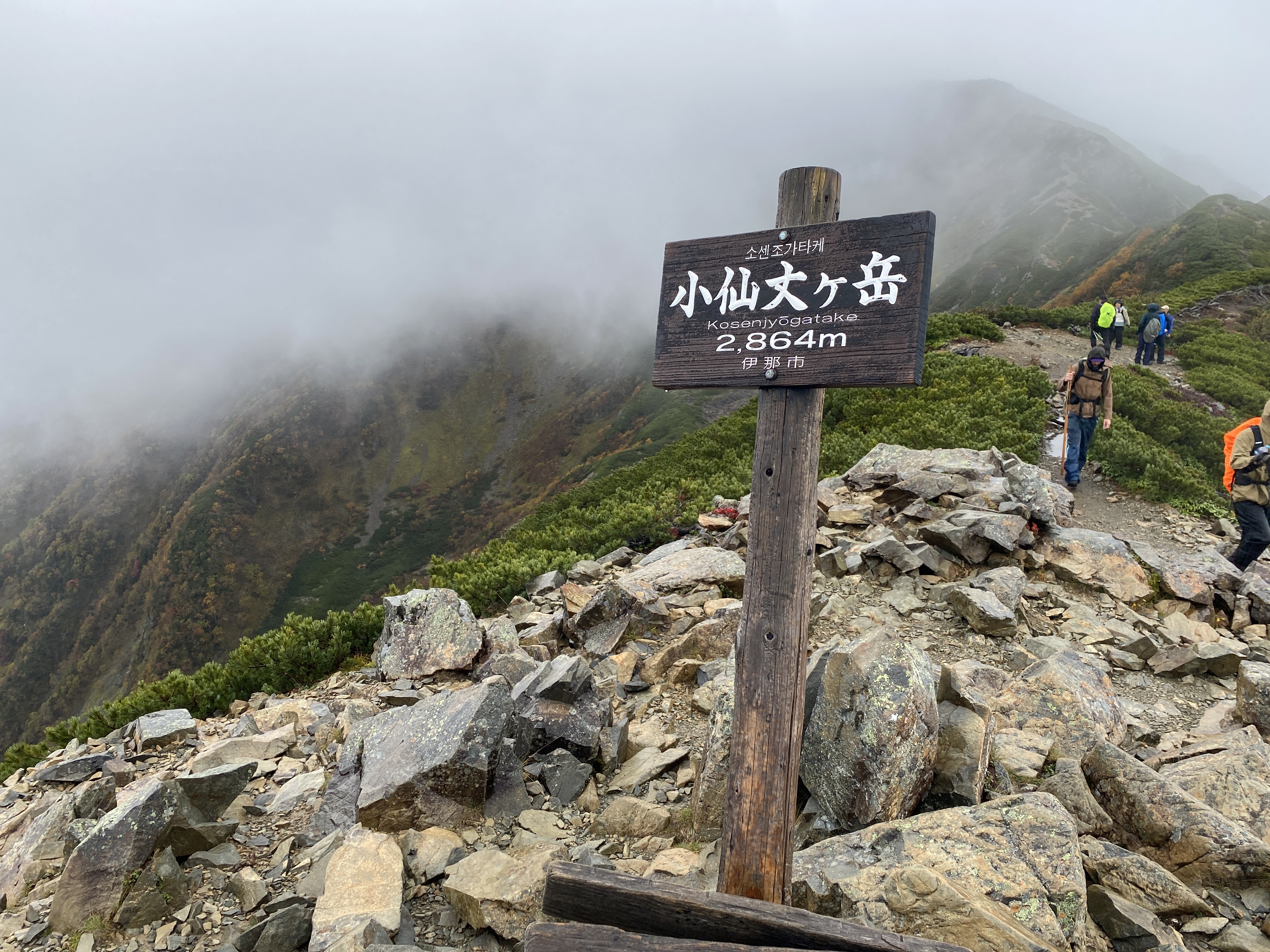
The first peak of the day, Kosenjodake.


Linger on this picture a minute.  It'll move.


Senjo

Japan has so many beautiful flowers.

flowers


Daisenjodake.
3rd peak of the day.


Senjo Hut


The Senjo Hut has a viewing deck.  Unfortunately, visibility was bad.😢
These trees are directly below the deck.

From Senjo Hut


This is a ptarmigan, raicho (雷鳥) in Japanese.  The x in ptarmigan is silent.  The characters for raicho directly translate to "thunder" "bird".  I wish it was thunderbird in English.  That sounds way cooler than ptarmigan and is a lot easier to spell.  I came across a family of four of them near the Senjo Hut.  

After the birds, I made a slight detour to try and bag one more peak, Mt. Uma no Se, ("Horse's" "Back").  I encountered a lot more leafy trees in this area than usual.  Even though the maple trees aren't changing yet, some other leaves have turned.  There are a lot of gnarly looking birch trees in the area that are cool, too.


The top of Uma no Se is somewhere up there.  I wasn't sure if I could get up there because there is no trail on the map and the area is covered with Siberian Dwarf Pine.  I'm always hoping to bag another peak, though!
Uma no se

I tried pushing my way through the pine searching for a trail for a while.  ('Dwarf' Pine my ass.  It was over my head.)
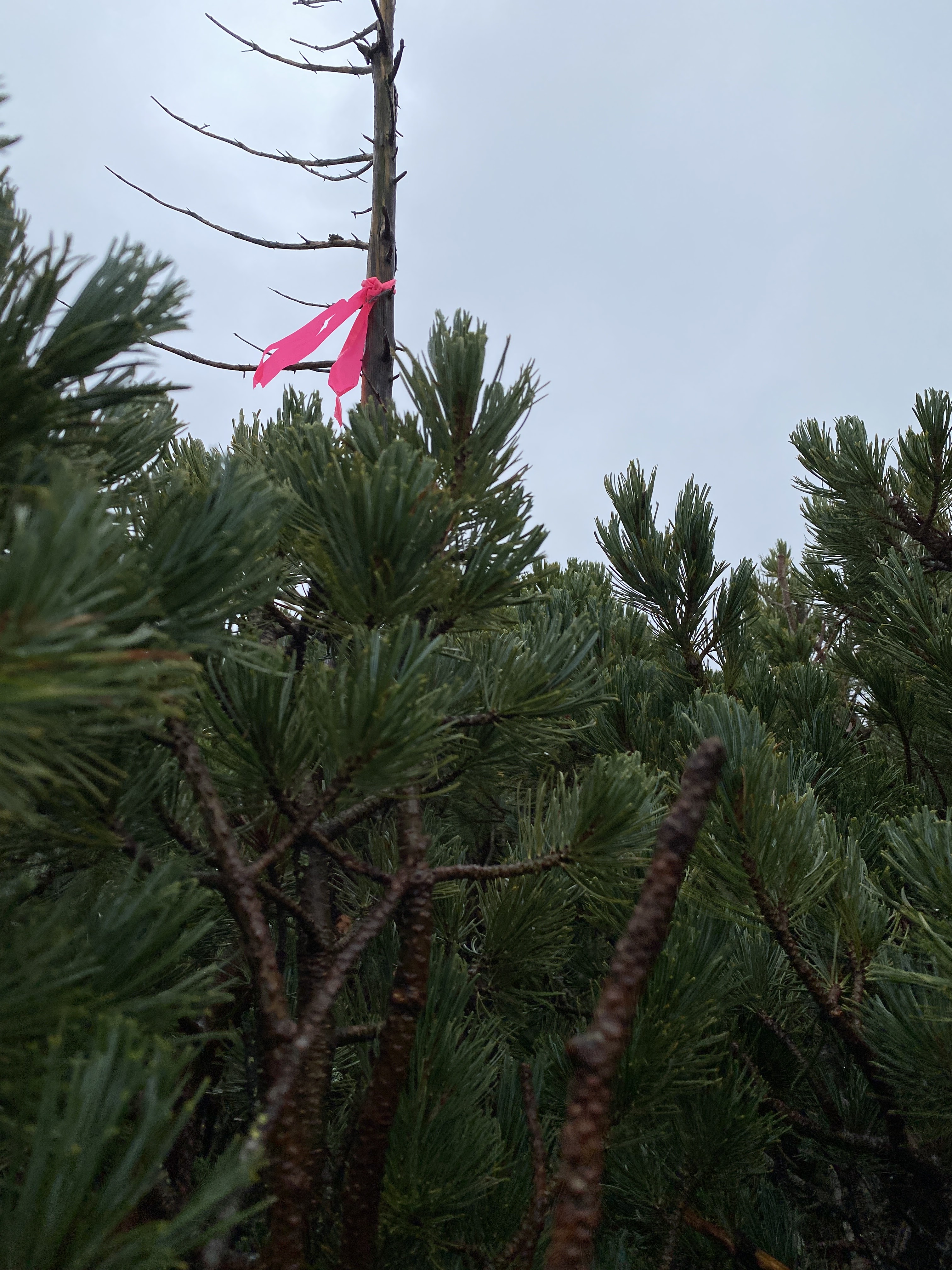
Then I saw a pink ribbon!  Those are used to mark trails.  Hooray!  I fought my way over to it only to find it was a cruel joke.  There ain't no stinking path anywhere.  Who put that ribbon there, and why?  I'll never know.


I don't know if there is any other marker up there or not . . . 


It'll be our secret.  😉


This is the closest the sun came to making an appearance today.
It was like this for approximately 10 seconds.


The Uma no Se Hutte (Hut)  (Link at the beginning of this post.)


Inside


The next sight to see was a stream and several falls.


errri


Next stop was the Komorebisanso by the Kitazawa Bus Stop to wait for the bus home.
I blew it on the time.  There is a bus at 1:10 and the next one isn't til 3.  I got to the bus stop at 1:30.  D'oh!
Interestingly enough, although cell service was fine on the mountain, there is no signal around the pass.  You can use the wifi in the Komorebisanso but it was like ¥600.  Yikes.  

Despite the price of the wifi, the Komorebisanso is a nice, clean place.
One thing I appreciated is that they have some running water and brushes they let you use to wash your gear off.


My personal graphic designer/retail magnate (AKA Mrs Caveman) appreciated this display.


Well cavedwellers, that's all.
I have had a hard time concentrating on making this blogpost.  Mrs. Caveman
and I have plans to go camping in a few days and I have a few more hikes I've
been scheming and daydreaming about these days.  I feel like a kid in a candy store.

If you haven't subscribed to the blog, what are you waiting for?  If you're really happy, try out the buy me a coffee button.  I could use a new pair of boots. (That's a standing headline if ever there was such a thing as a standing headline.)

If you really haven't had enough of this mountain, look at this:


The hike to the adjacent 100 Famous Mountain Prince of the Alps, Kaikoma is worth checking out.

That's all.
Caveman out