Hiking a 💯 Famous Mountain, Mt. Kuju in Kyushu, Japan 久住山・九重山


A view from Mt. Kuju


. . . about Mt. Kuju (久住山or九重山)

Mt. Kuju is in the Aso-Kuju National Park in Oita Prefecture on the island of Kyushu.  This is a volcanic region and has great views.  The Nakadake peak next to Mt. Kuju is the highest point on the island.

Area:

Location:

Map:  This link is to a printable topo map

Starting and stopping point: 

Akagawa Trailhead 赤川登山口 near the Akagawa Onsen

Peaks bagged: 

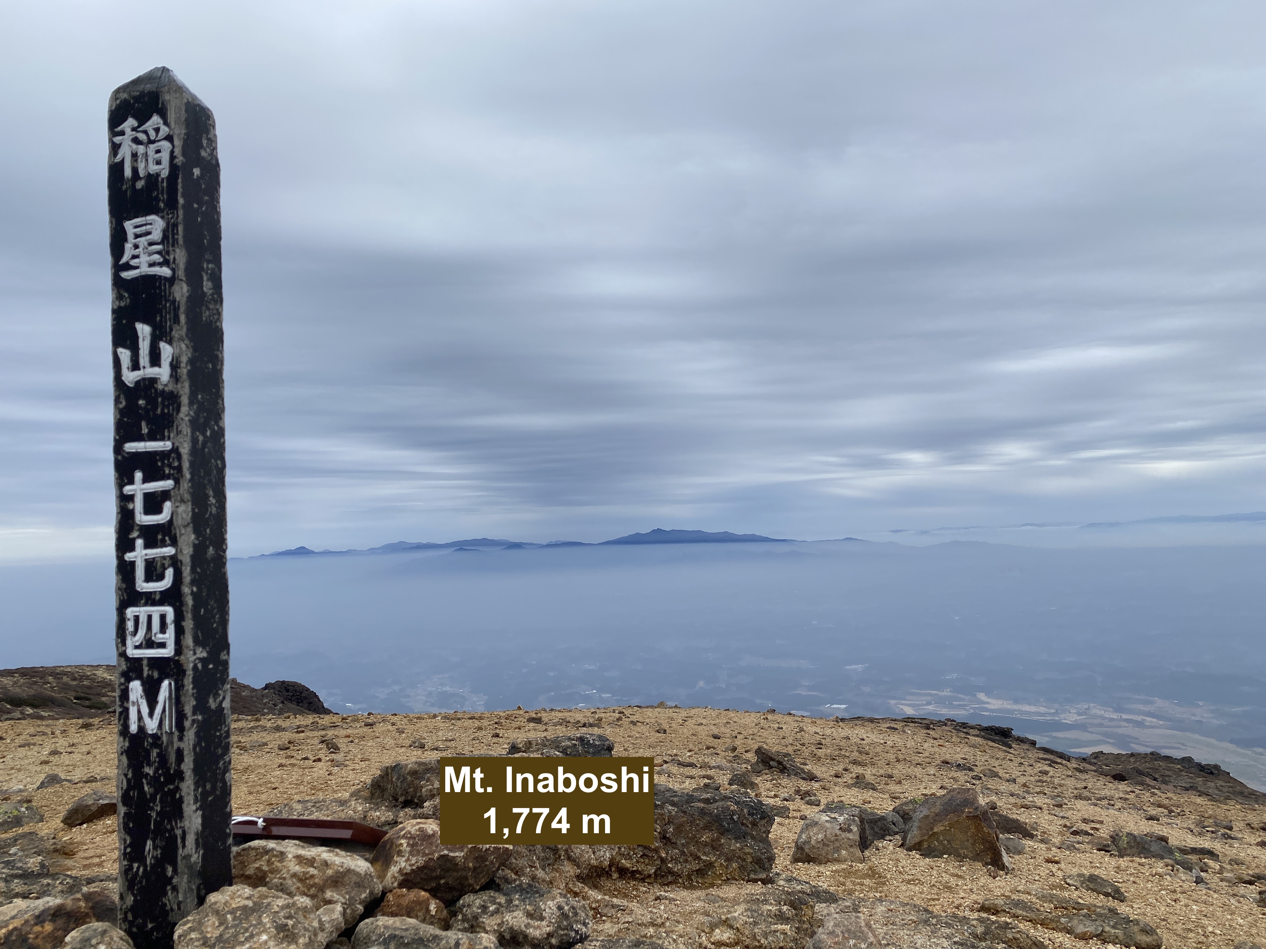
Kuju (久住山or九重山) ~ Tengugajo (天狗ヶ城) ~ Nakadake (中岳) ~ Inaboshi (稲星山) 

(First-time) peaks # 1,007~1010


Getting there/getting around:  

Drive.  There is free parking.  No public transportation to this trailhead.


Helpful Info

Weather Information: Mt. Nakadake of the Kuju Range

Time and distance

Total Time:  5:07 Break time: :29  Distance:  8.9 km
Elevation:  Lowest: 1,029 m Highest: 1,791 m  Total Ascent:  1,052 m Total Descent: 1,050 m

Technical considerations/difficulty:  

Much of this is fairly steep and there are ropes you need to use to get up.  On the descent, there was a long section of black, slippery mud.  This section has ropes that you really need to use lest you slip.  I counted myself as very lucky that I didn't slip there because it would have been impossible to wash that mud out. 

Facilities:  

Toilet at the parking lot.  There is an onsen near the parking lot but that has a lot of days off.  There is nothing on this trail.  There is an emergency hut or two in the area.  There is one waterhole annotated on the Yama to Kogen map but there was only a trickle of water when I was there (March).  Someone noted that it was dry when they were there in August.


Thoughts/observations/recommendations:  

As always, this was a great hike.  Kyushu is far from my area and I'll probably not be there again but I'm glad I went.

Here's a video if you're into that


earth


The Cavecar drove from Nagano to this trailhead via Hiroshima and Nagasaki.  Four days after beginning this trek, upon finally reaching the beginning of the first hike, the car died in the parking lot at the trailhead.  I called JAF (Japanese Auto Federation) and the wrecker driver came out.

As often happens, when the mechanic arrived, the mechanical problem disappeared and my car started right up!

I thought the prudent thing would be to give up on the hike and drive to a car dealer and to get it checked out more thoroughly during the day rather than risk it breaking down later in the day.

That would have been prudent.  But I have never met Prudence so I decided to hike first and worry about whether I could make it home later.🤓👍😜

Thankfully, the car was ok after this incident.

Lots of volcanoes down here.  You always have to beware of the alert levels.


Not too cold.


2.5 km later after hiking for an hour, I reached the top


御池 "O eekay"--"Honorable Pond"


Looking toward Mt. Aso


This was nerve-racking.


The Akagawa Onsen
(was closed on that day).


The sign says it's potable so I filled a water bottle.  I thought this was really cool.
Well . . . you can drink the water but I wouldn't recommend it.  Wow.  That was gross.
If you've been around volcanoes or hotsprings, you have an idea of the smell.  The taste is similar to the smell.


Not only did it taste bad, there is aftertaste.  Every time I burped, I tasted it again.


Even the next day--after refilling the bottle with different water--the taste lingered in my water bottle.


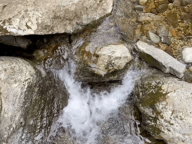
The view of the river by the onsen


Well, I guess that is it for the Caveman today.

If you haven't subscribed, what is wrong with you?

Also, this is a shameless plea.  I would like to ask for your financial support.  There is a paypal link somewhere.  (Buy me a coffee.)  Use it.  Share it with your friends.  The Caveman could probably use a new car and always needs boots and socks.

Do you like volcanoes?  Check out this one in the Caveman's backyard
https://mymancaveisthemountains.blogspot.com/2024/10/viewing-pearl-asama-moon-very-cool.html

If you want to see more of Kyushu, check out this hike on Mt. Sobo.


Hiking a 💯 Famous Mountain in Kyushu, Mt. Sobo 祖母山、九州


top


. . . about Mt. Sobo (祖母山)

This is one of the 100 Famous Japanese mountains and is located in Oita Prefecture and Miyazaki Prefectures on the island of Kyushu.

Area:

Location:

Map:  ***If you want a link to the latest Yama to Kogen map, comment and I'll get you a link.  This link is to a printable topo map of Mt. Sobo.

Starting and stopping point: Kitadani Trailhead 北谷登山口

Peaks bagged: Mt. Sobo   祖母山

(First-time) peaks # 1,011

(First-time) 100 Famous Mountain peak #48


Getting there/getting around:  

Drive


Helpful Info

Weather Information: Mt. Sobo  Mt. Sobo Weather in English

Time and distance

Total Time:   4:00 Break time: :31  Distance:  8.1 km
Elevation:  Lowest: 1,097 m Highest: 1,756 m Total Ascent: 845 m  Total Descent: 845 m

Technical considerations/difficulty:  

Fairly steep.  There are a lot of ropes and ladders.

Facilities:  

There is a public restroom at the trailhead.  Nothing on the trail.

Thoughts/observations/recommendations:  

This is one of three 100 Famous Mountains in central Kyushu and each of them have the other two (Sobo, Aso and Kuju) in sight.

The Fuketsu (wind cave) on the trail is interesting.  Bring spikes and a strong headlamp for that.


Here's a detailed video of the hike if you're interested.


Those wasps--"suzumebachi"--are more of a danger than bears.  Those snakes--"mamushi"--are not something I'd like to encounter either.


Restroom at the parking lot.  Still closed for the season.


I really love running water.


A sign describing the path as it passes the wind cave.
The wind cave is about 20 meters deep.  I only went in about 3 meters because it was wet and my headlamp didn't light the place up at all.

Inside the cave


Plenty of upper-body strength is needed


Mt. Aso


Looking toward Kuju


The top of Sobo
Sobo (祖母) means grandmother, by the way.


The convergence of three prefectures; Miyazaki, Kumamoto and Oita


Well, that's all for today.  If you want to see another hike in Kyushu, check out the hike I made the day before on Mt. Kuju.

Caveman Out


PS  Did you subscribe?
How about clicking the buy me a coffee link?  I'd appreciate it.


The 500th that got away again.

Consider this a non-report.


Astute readers of this blog (all two or three of you) know that I have climbed something like 1,000 peaks.  

About 3 years back when I was approaching #500, I decided to climb a mountain named 500 (Gohyakuyama in Japanese) to commemorate the occasion.  There happen to be two mountains with that name in Japan.  One is in Niigata Prefecture and the other is in Nagano Prefecture.  They are both small, little-known and little-trafficked mountains.  

For my first attempt, I went to the one in Niigata on a February day.  I didn't realize until I got to the trailhead how unprepared I was for the snow.  I assumed the conditions of that mountain would be similar to mountains of the same height in the area I usually hiked around Tokyo.  I was wrong.  I hadn't taken into account that Niigata, being near the Sea of Japan, gets a lot of snow--even at lower elevations.  I didn't have snow shoes or anything like that with me.  After traipsing  around in thigh-deep snow for a short while, I gave up and went home.  

(For #500, I went to Gohyakuyama in Nagano a few weeks later.)

This year, with #1,000 coming up, I have had my sight on the one in Niigata again because 500 + 500 = 1,000.   I'm more prepared for snow these days.  I sought out hikers in the local area to pump them for information about the snow conditions.  I was ready to do it in early February--and the conditions looked good--but I had other commitments and had to wait.

Then, when I had time, the area got belted with snow.  It snowed for a week straight and was snowing on the day I had available to hike.  

Yesterday, I had the time and it wasn't snowing.  The concern was that the area had gotten all that snow recently and then had a few really warm days.  The snow could be heavy and there might be danger of snowslides.  The guys I had been talking to online said they thought the conditions were good, though.  Mrs. Caveman drew my attention to an avalanche warning for Niigata and I said maybe it wouldn't apply to such a small mountain.  Mrs. Caveman had better information than the guys on the ground.

I'm sure she's better-looking, too.

Well, the conditions were not good.  I could see driving into the area that the snow was very dangerous and there were bound to be avalanches so I decided to give up even before I got to the trailhead.

Drats.  Foiled again!

I don't know what those local guys were thinking saying the conditions were good. Was it something I said, I wonder.

I'm resigned to waiting to do this mountain until spring.  Truth be told, I've already crossed the 1,000 mark but we'll just pretend that hasn't happened until I finally knock this one off as the 1,000th.   The Caveman will get his revenge.  This little mountain has now cost me probably 12 hours in travel time and lots of money.  The first time I went was by shinkansen from Tokyo.  Tolls and gas yesterday were about ¥15,000.


The ride home was pretty.  I got to see lots of mountains.


Mt. Myoko was a nice hike.  That report is here.

Caveman out